UPDATED: The flaw was not in the ECDO theory but in the physics of my own simulation modeling. The Ethical Skeptic’s community helped identify the gaps and I have since run new simulations that actually added more simulated proof of ECDO theory after all.
Leaving this post up because I will always own my errors or mistakes. The original story is below.
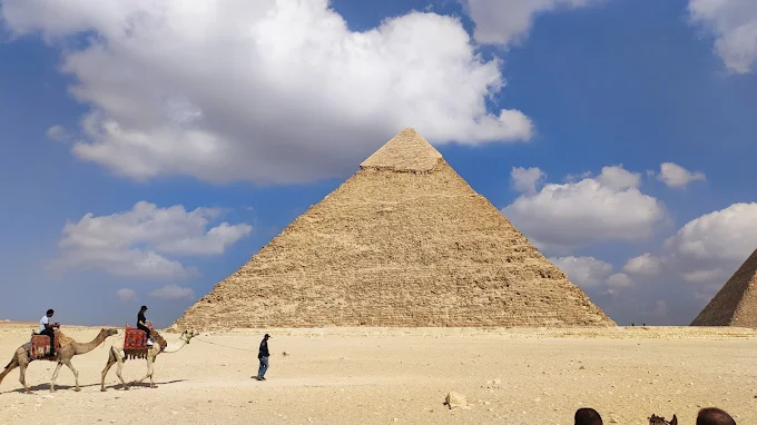
I got into this true polar wander simulation via The Ethical Skeptic and his ECDO theory. However, I’ve hit a major roadblock in my simulation runs with his theory and claim that the Khafre Pyramid had the sea washing up on its peak for hundreds of years causing the unique and clear water damage at its peak.
The Problem
The math suggests there is no way the water level could have reached the peak of this pyramid during State 2 of the ECDO model. In simulation after simulation as I fine tune this program I built, the North Africa region is well above sea level.
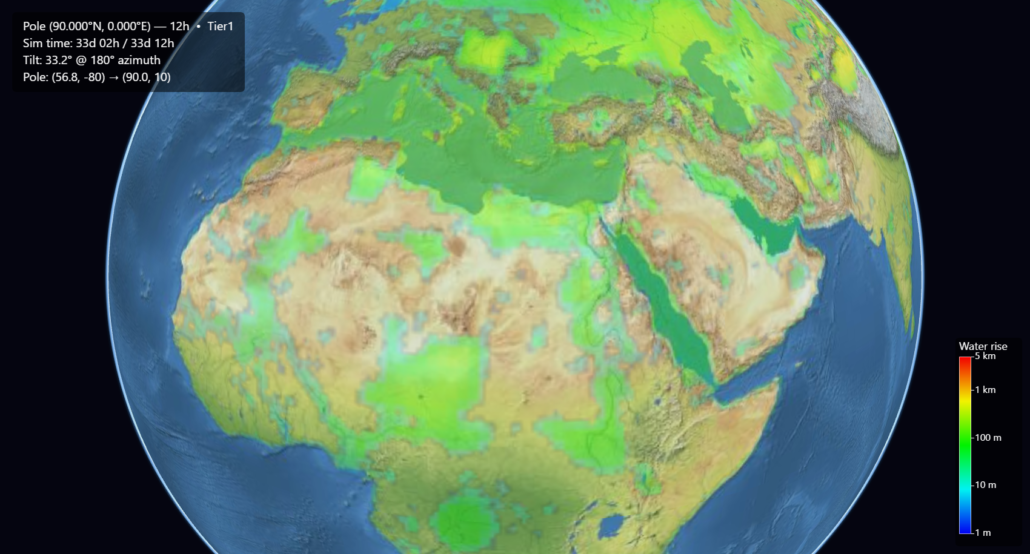
As you can see from this screenshot I grabbed of State 2 water levels prior to moving back to State 1, the Giza Plateau is actually many kilometers above sea level.
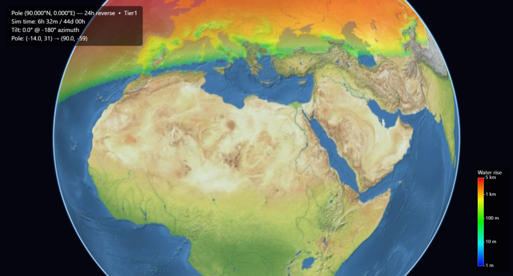
The overlay above in Europe shows what the sea level on that continent would have been during State 2. The equatorial bulge of water would have buried it.
This data makes it very hard to reconcile the ECDO theory with the geological evidence at the Giza plateau site.
Hudson Bay keeps showing up though
However, if the Hudson Bay region were the north pole for thousands of years and sea levels were not lower, we’d see Giza at the perfect elevation to receive the weathering it has.
I’ll always be fascinated by the Hudson Bay theory even if its been debunked. It keeps showing up where I least expect it – including here in Africa.
This would theoretically place the Giza plateau exactly where it needed to be to have the pyramids partially flooded.
That is … if the sea levels were the same 12,000+ years ago as they are today. They were not.
Sea levels today are several hundred feet higher than they were then.
Even so, the Hudson Bay model puts sea levels dang close to matching the evidence seen in Giza. Maybe I shouldn’t reject Charles Hapgood’s belief there.
No ECDO scenario that works with Giza underwater
In trying to get the scenario for ECDO to match the water damage made to the pyramid, I was shut down my math.
I got so desperate that I shared my findings with Craig Stone asking for help overcoming the data and he pointed me down the path of checking the Straight of Gibraltar being fully blocked thus overfilling the Mediterranean Sea and the Giza plateau.
However, even with that extreme example the math just came up short on all fronts. I even tried to force AI to help me find a path to generate the result I wanted and it conclusively rejected the possibility.
The water surface inside the Mediterranean must remain an equipotential surface parallel to the new geoid. It cannot “tilt” arbitrarily; gravity and rotation force it to follow the same ellipsoidal shape. Raising the entire surface outward by some uniform Δr (in potential terms) simply shifts the whole Mediterranean sea level parallel to the global one.
To submerge Giza, the Mediterranean water surface would have to reach at least rGiza land — i.e., the equipotential would need to be raised by Δr≥5.734 km above the nominal new global sea level.
The Mediterranean surface area is ~2.5 million km². The extra volume required is approximately
Vextra≈2.5×10⁶km2×5.734km≈14.325 million km3.
This is roughly 1% of Earth’s entire ocean volume (~1.335 billion km³). A “flood that spilled over” from the Atlantic could never supply or sustain that volume without the barrier at Gibraltar being an impossibly tall dam.
Conclusion: Even with today’s sea levels, a blocked Gibraltar, and a massive spill-over flood filling the Mediterranean “fully,” the Giza Plateau remains ~5.734 km above the highest sustainable water surface in the closed basin. The rotational geometry itself prevents flooding; the plateau would stay high, dry land, with the new Mediterranean shoreline far below and to the north/northeast of it. This outcome is robust across all reasonable interpretations of the scenario and underscores how profoundly a reoriented rotation axis reshapes apparent sea levels on a fixed crust.
This isn’t a rejection of the ECDO theory. There is ample data behind it to support it beyond just this one anecdotal example.
However, for the pyramid to exhibit these signs of water damage it would seem to have needed to come from somewhere else. I’m open to being proven wrong and I will continue to heavily simulate ECDO models, because it still remains the strongest candidate to the evidence of cataclysm.