I’m obviously playing around with a new toy with this simulation program I built, but I did go down a rabbit hole based off a tweet posted by Nobulart. I wrote my first ever article on X about it, because the data was fascinating.
https://twitter.com/HashZappa/status/2050389138130767876
TL;DR version is that they discovered an ancient coastline from 12,000 years ago in New Zealand at the 550 foot sea level. There were a variety of possible North Pole locations that would naturally rise the sea level to that point with the most logical one to me being in the southeastern portion of the Hudson Bay.
This is logical because that’s where the damn 2 mile thick ice sheets were during the last “ice age” as they call it. No ice age, just a polar ice cap.
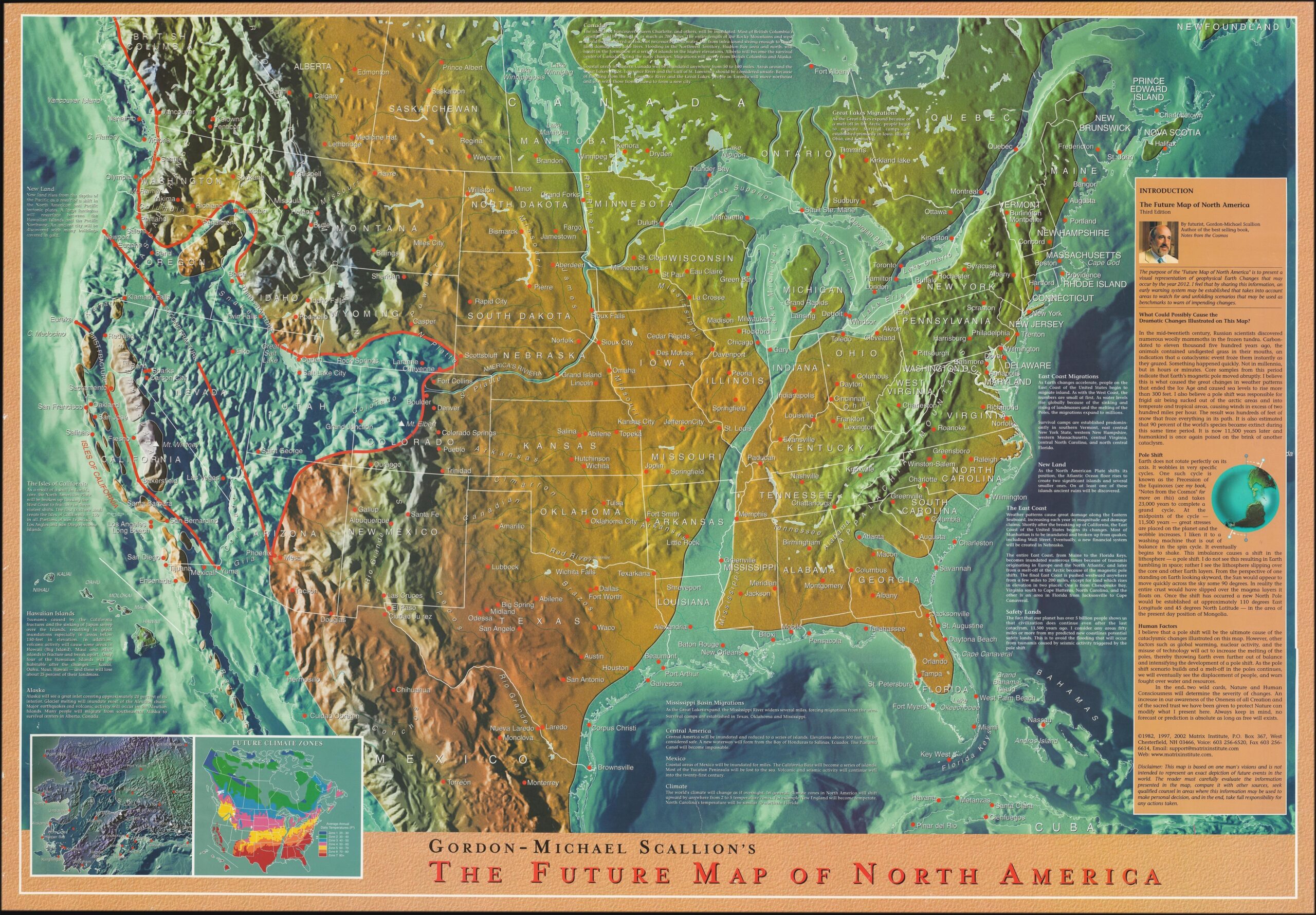
Anyway, back to Edgar Casey. This is a version of his famous vision of what the future of the United States would look like.
Essentially, the country is supposedly split in half and the western USA into the sea.
Well, I decided to run a reverse simulation from the Hudson Bay to the present-day North Pole and… I noticed something oddly precise about how North America looked once the move was done.
I sped up the sim for sake of brevity. But at the end it looks suspiciously like the continent described by Edgar Casey in his dream-state. Perhaps he was merely remembering what humanity has long forgotten…
Just another interesting caveat. This is why I cannot firmly back any theory, because the conflicting evidence is in every simulation.
Happy Friday, folks!