I’m a wandering pole guy, but the primary evidence that makes me think maybe the shift is the same direction each time (e.g., EDCO theory) is desertification. If the same region is repeatedly obliterated by sea water in specific arid conditions could create permanent desertification of the soil.
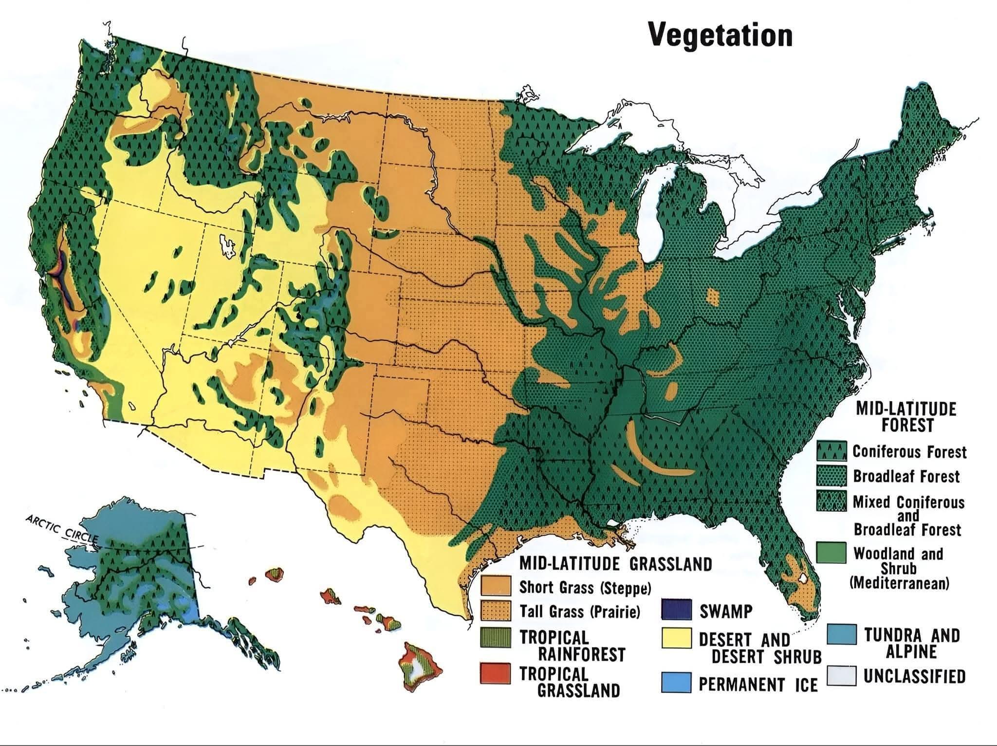
If so, then this map could be a good indicator of how far and how high the waters reach. With the West Coast hitting the Pacific Ocean hard, the depth of the ocean could overtake the higher elevation of the Great Basin region.
Aside from this map, the topographic also looks like water has carved mountains that all face in relatively the same ne/sw direction.
These are just some random Thursday thoughts. lol